Timelines and Maps of the Netherby's Voyage.
Scroll down for information about King Island and the wreck location.
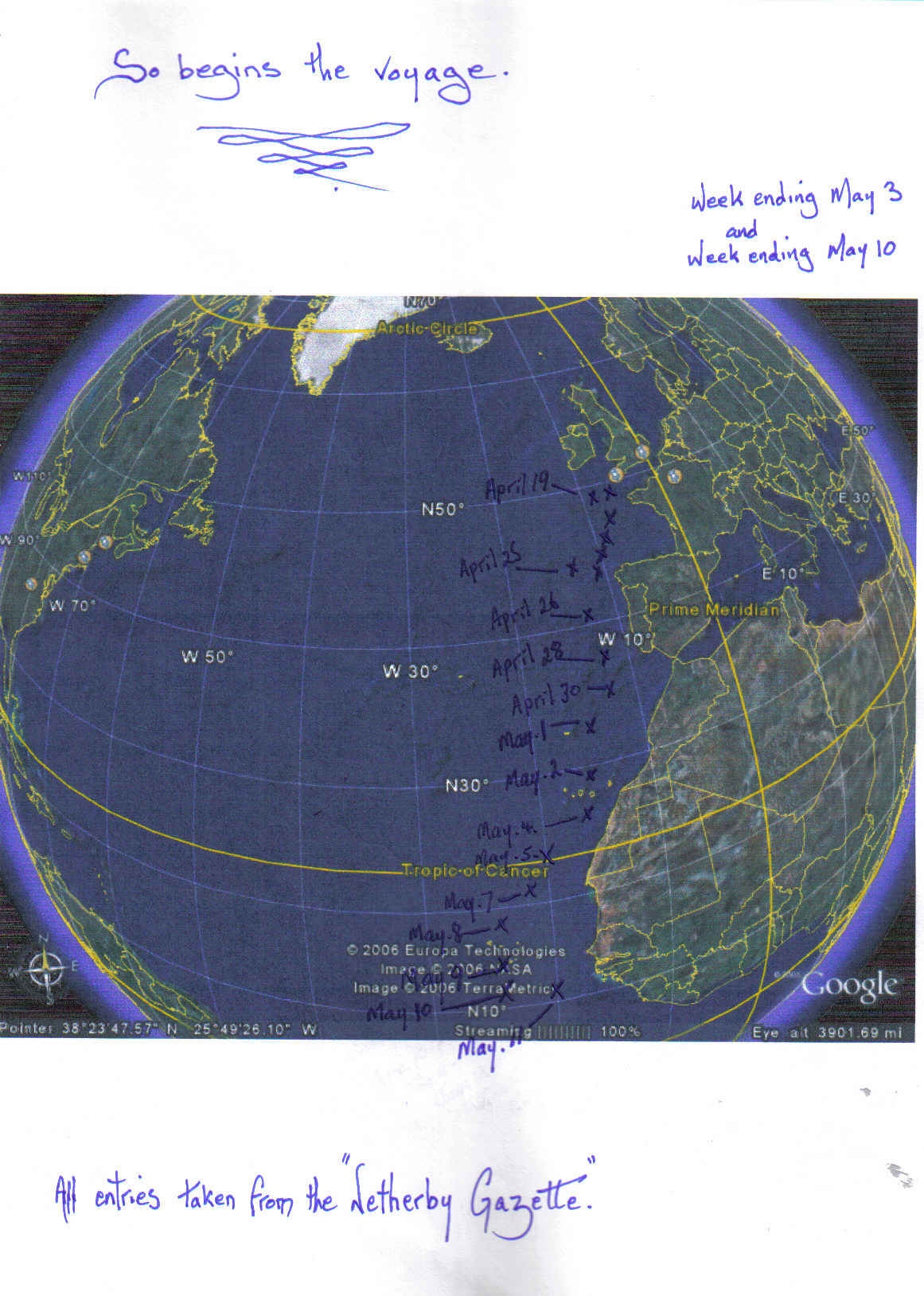
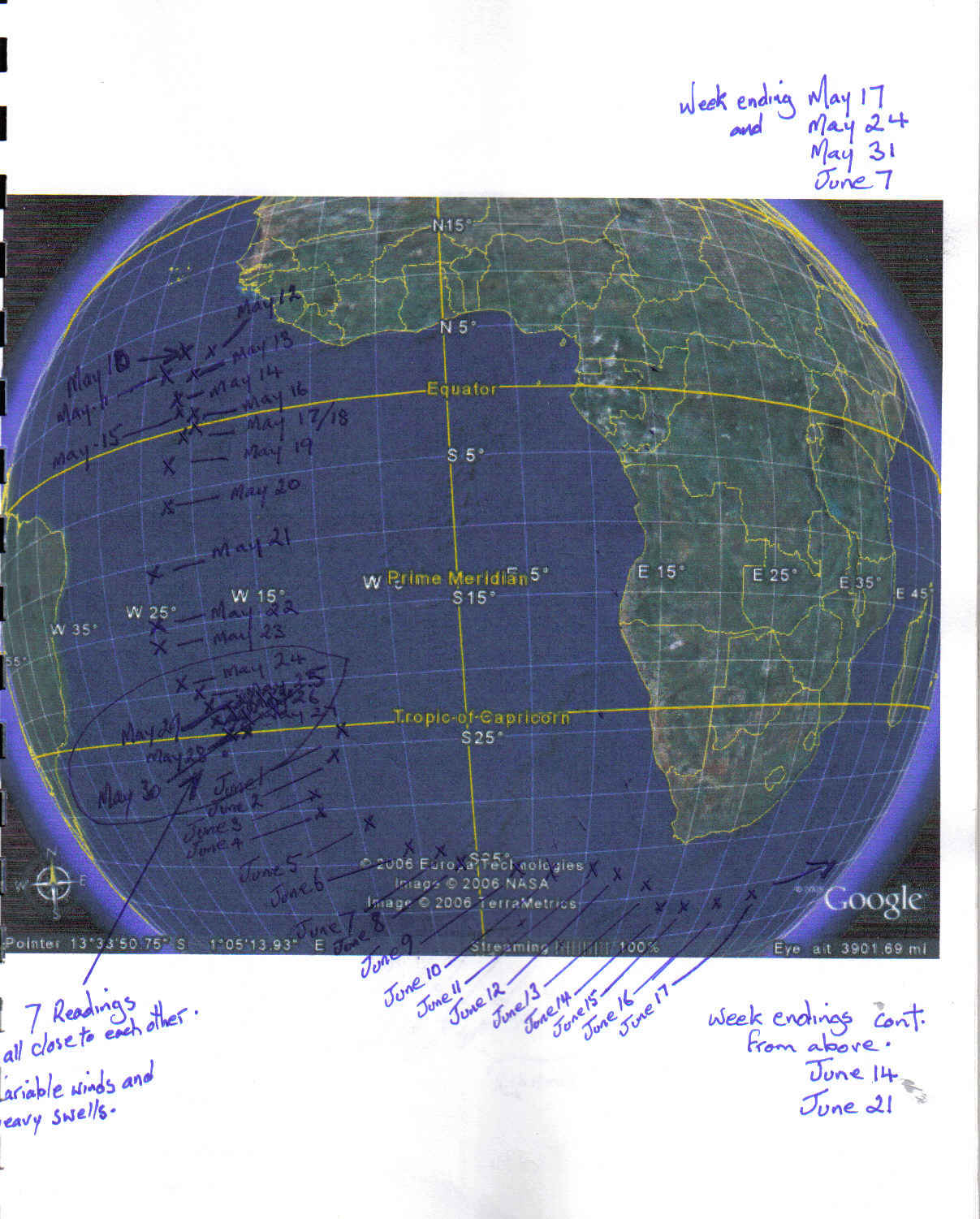
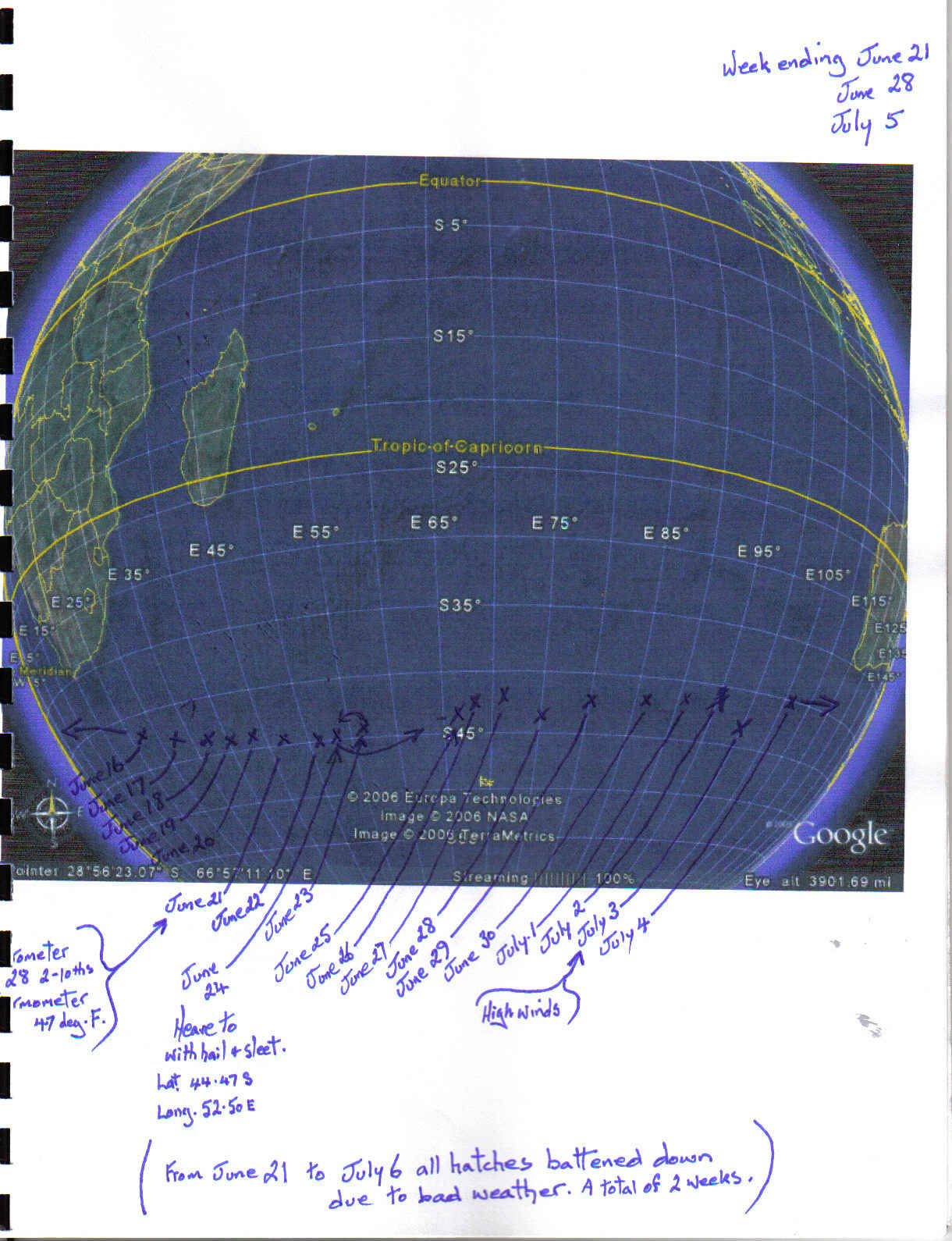
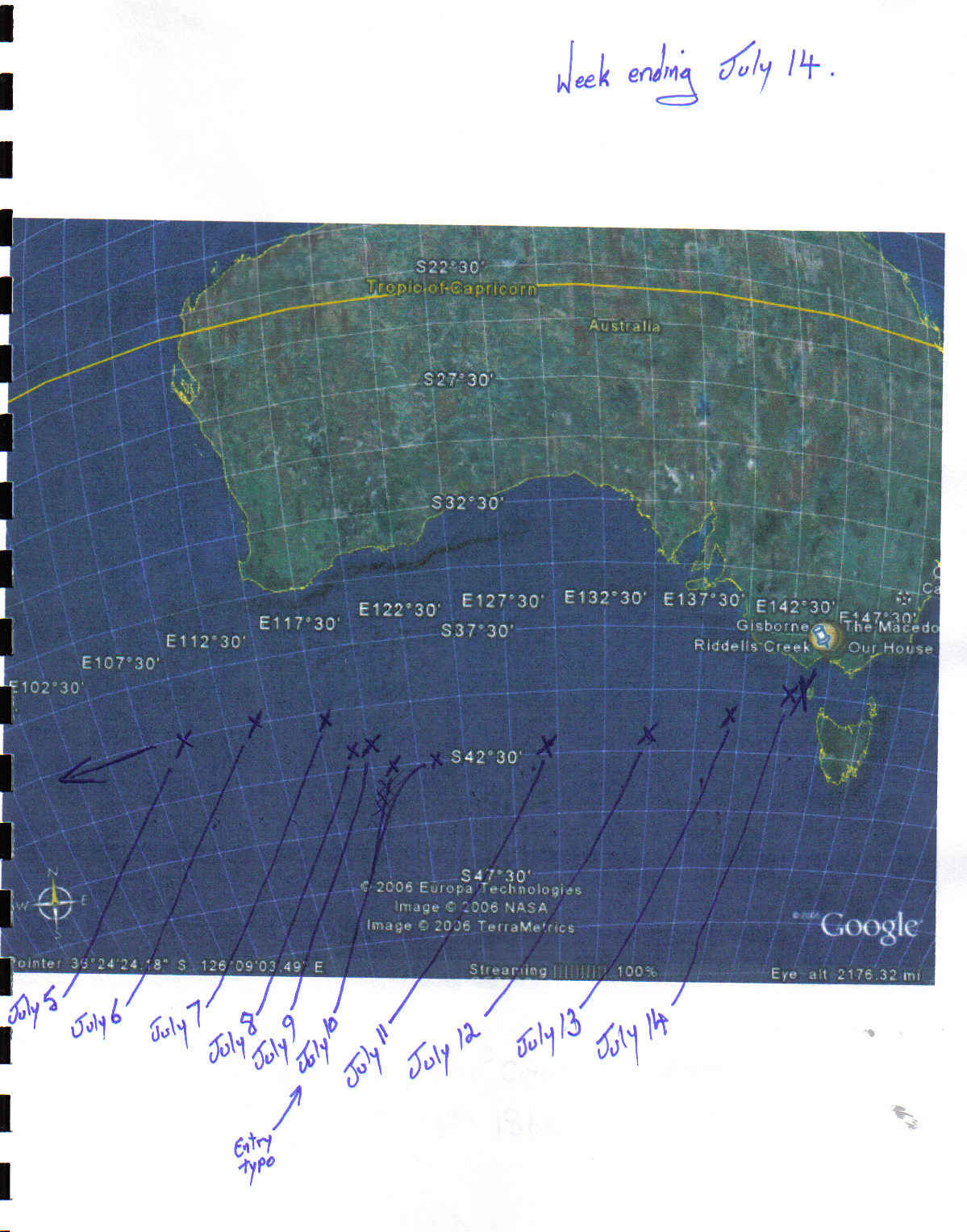
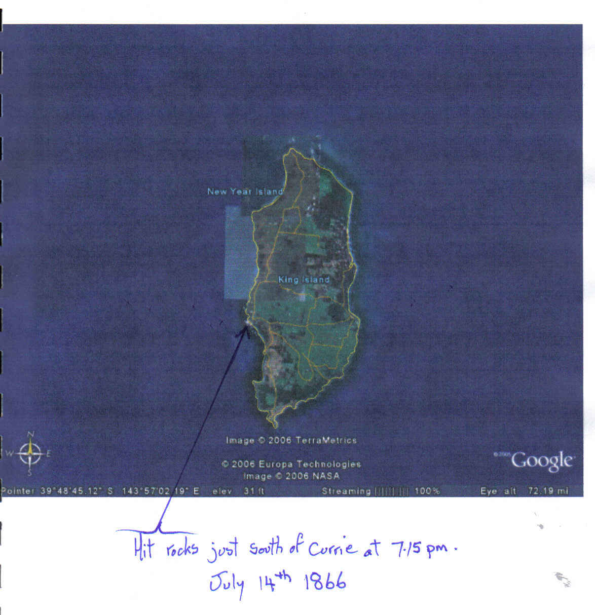
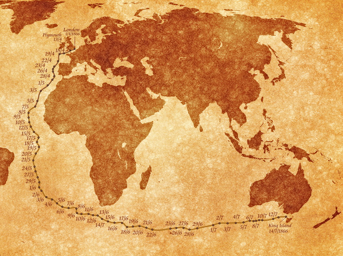
Thank you to Larry Lingard-Davis for creating these Google maps showing the timeline of the voyage.
Thank you to Merv Pope for making this map for me when I was designing the photo book for the 150th Commemorations
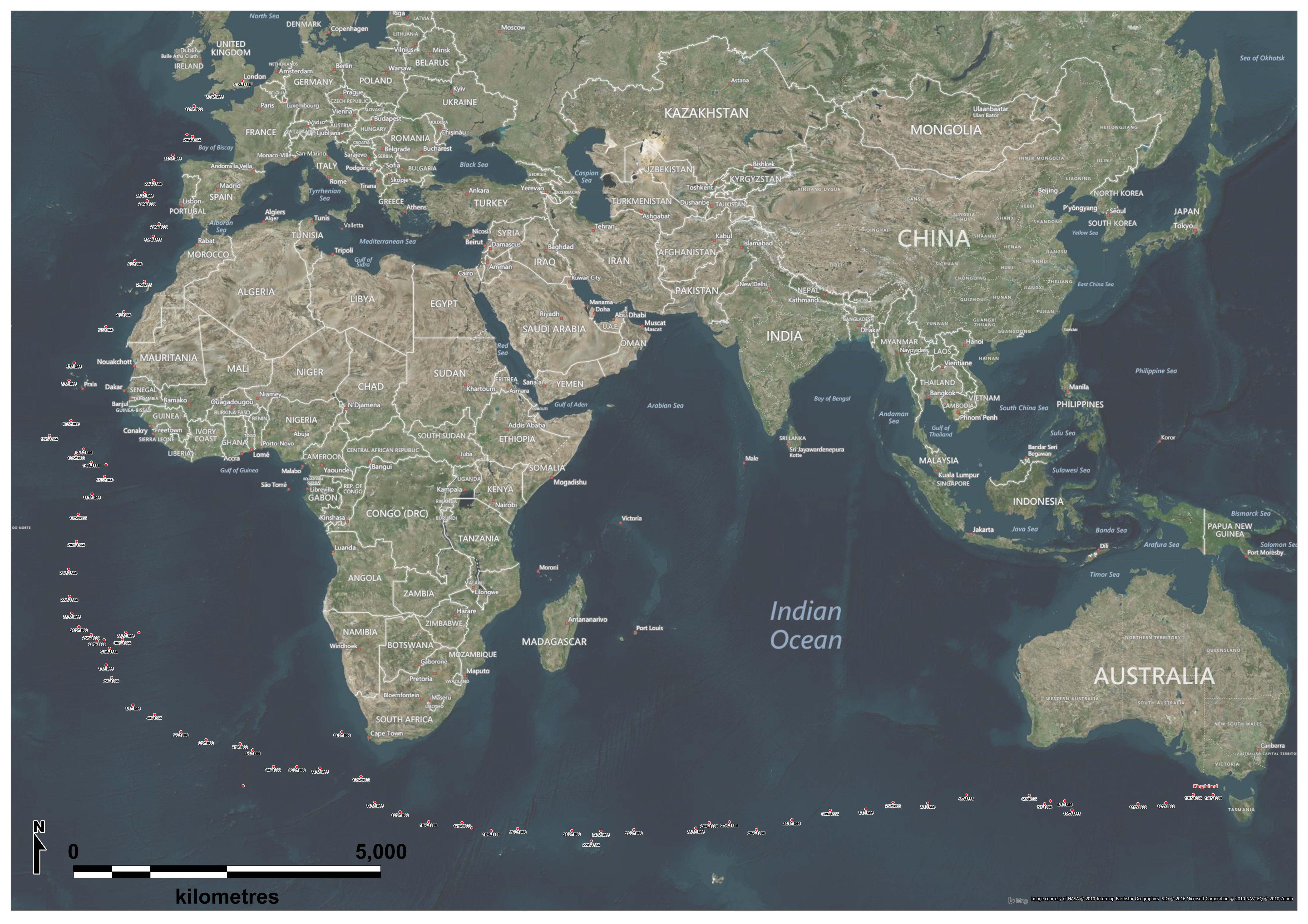
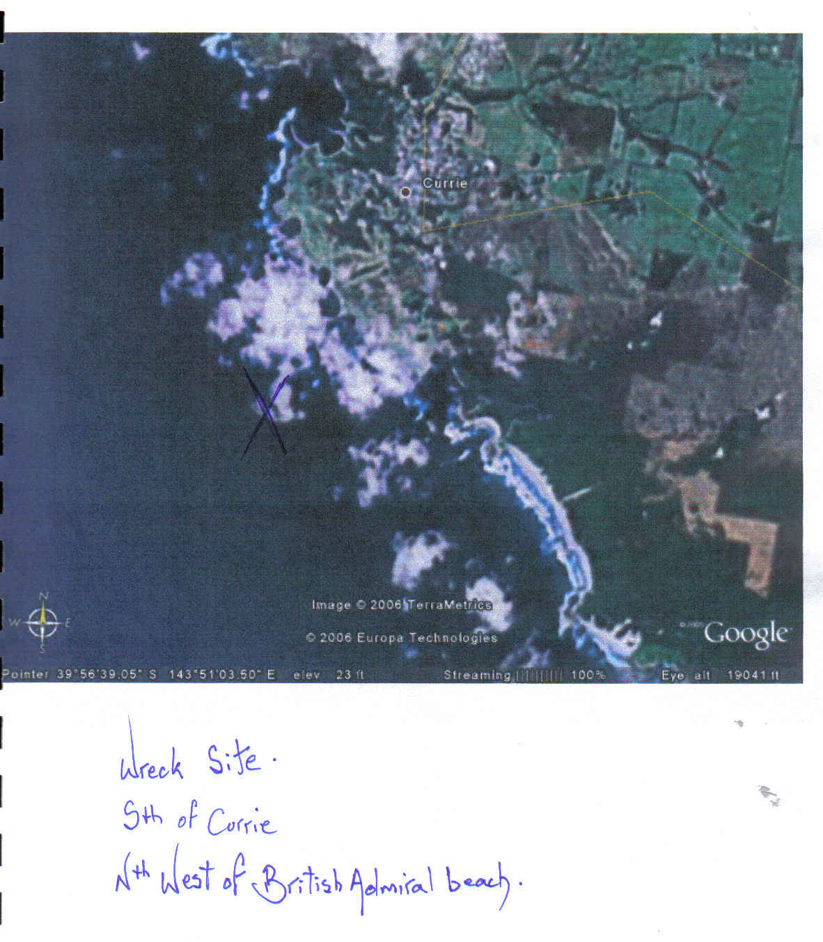
Thank you to David Peters for making this map for me when I was designing the photo book for the 150th Commemorations. A full sized version was placed in the sea chest time capsule, located in the King Island museum.
King Island Shipwrecks
When you note the location of King Island it is easy to understand why it has been named The Graveyard of Bass Strait. Lying at the western end of Bass Strait, the island forms an impenetrable barrier to ships that sail too far south on entering the Strait, making for Port Phillip or Sydney. Ever since Bass Strait was charted by George Bass and Matthew Flinders in 1798, many ship’s captains have decided to risk the dangerous passage to shorten the time to reach Sydney. Many have come to grief.
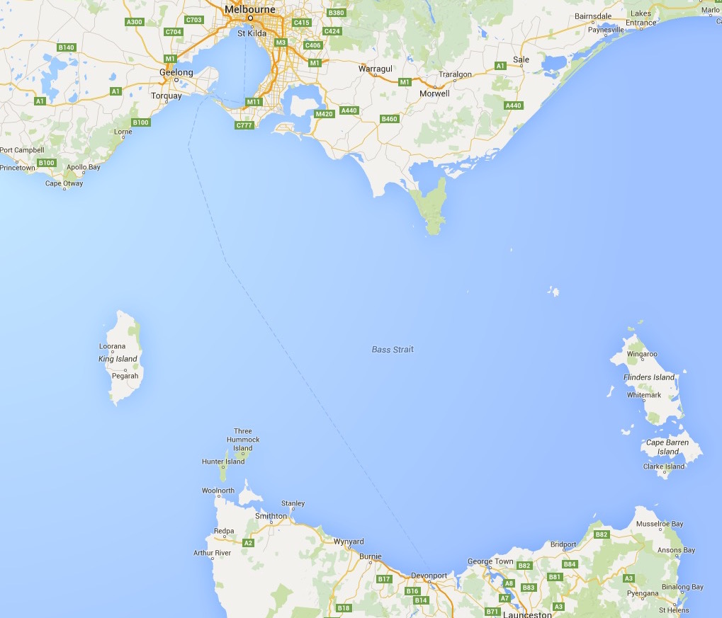
Over one hundred vessels, large and small have been wrecked on the island, with the loss of over 700 lives. The Cataraqui, with 399 lives lost, remains as Australia’s greatest single national civil disaster. The island was first discovered in 1798 by Captain Reed in the Martha, and named in 1801 by John Black, commander of the Harbinger, after Governor King. The island stands guardian to the western entrance of Bass Strait , 64 km long and 26 km wide, about 80 km north- east of Cape Grim on the north-west tip of Tasmania, and 100 km south-east from Cape Otway in Victoria. It is relatively flat with no high peaks.
Vessels on their last leg to Melbourne and Sydney from England had to "thread the eye of the needle"; having rounded the Cape of Good Hope, and taken the Great Circle route which led south into the Southern Ocean, captains had to navigate through the comparatively narrow 100 km entrance to western Bass Strait - too far south and they ran on to the shores of western King Island, and the smaller New Year Isles, too far north and they struck the western Victorian coast. For a time, the lights from Cape Otway (Victoria, 1848), and Cape Wickham (King Island, 1861), were confused adding to the destruction. The tallest lighthouse in Australia is located at Cape Wickham to the north of the island, a beautiful white granite tower 52 metres high, its light visiblefor 54 kilometres.
Of the 140 or so wrecks around the island, the tragic loss of the Cataraqui is the most significant, followed by the convict ship Neva, 218 lives, and the iron ship British Admiral, 79 lives. The largest vessel lost was the fully-rigged ship Carnarvon Bay, 1932 tons, lost at the southern end of the island in 1910. She has not been reported as found. The fully-rigged ship British Admiral, 1808 tons, lost 1874, is next, followed by the Loch Leven, 1439 tons, 1871, and the barque Flying Arrow, 1100 tons, 1855.
All of the major vessels, including the barque Blencathra, and ship Netherby, are well and truly flattened with little but scattered wreckage to be seen.
The King Island Maritime Trail “Shipwrecks & Safe Havens" tells some of the stories of the shipwrecks, both heart-breaking and heroic. It also tells of the safe havens set up at Currie and Grassy, and of the welcome lighthouses built at Cape Wickham and Currie.
In the words of keeper William Hickmott, “I suppose there are no lights in these waters so blest by sailors as the two upon King Island.”